Hi all,
This thread is compiled specifically with Brit Butt rallies in mind, but I guess answers might help others generally.
I've changed / upgraded* my satnav unit recently from a Tom Tom Rider v5 using Tyre to a Garmin 590 using BaseCamp.
I've had a play with it and I can now import rally bonus locations into BaseCamp to visualise them on the map. However, when I zoom out of the map a bit to see where all the locations are, the little flags are hard to see against all the other clutter on the map (major route names, town names etc.). on my laptop screen. This is especially relevant for bonuses in / around major cities - there's just too much 'stuff' in the way.
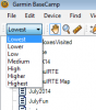
Is there a way of simplifying the map to remove all the stuff I'm not interested in? I couldn't see anything in the options to do so. Really, all I'm interested in for route planning purposes is an outline of the UK with maybe the motorway network drawn on it for good measure. I guessed maybe I could change the underlying map for a different one, but I don't know if that's possible.
All ideas / suggestions gratefully received")
TIA
*delete as applicable
This thread is compiled specifically with Brit Butt rallies in mind, but I guess answers might help others generally.
I've changed / upgraded* my satnav unit recently from a Tom Tom Rider v5 using Tyre to a Garmin 590 using BaseCamp.
I've had a play with it and I can now import rally bonus locations into BaseCamp to visualise them on the map. However, when I zoom out of the map a bit to see where all the locations are, the little flags are hard to see against all the other clutter on the map (major route names, town names etc.). on my laptop screen. This is especially relevant for bonuses in / around major cities - there's just too much 'stuff' in the way.
Is there a way of simplifying the map to remove all the stuff I'm not interested in? I couldn't see anything in the options to do so. Really, all I'm interested in for route planning purposes is an outline of the UK with maybe the motorway network drawn on it for good measure. I guessed maybe I could change the underlying map for a different one, but I don't know if that's possible.
All ideas / suggestions gratefully received
TIA
*delete as applicable